Thursday, April 12, 2012

The Indian Mounds!


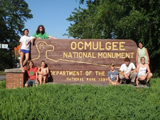
The Ocmulgee National Monument preserves traces of over ten millennia of Southeastern Native American culture.  The park contains the site of the Great Temple Mound, a burial mound, and other ceremonial mounds. The prehistoric people chose the site of Macon, Georgia to build their amazing landmarks because it rests right on the fall line where the Piedmont meets the Atlantic Coastal Plains of Georgia.  This area of Georgia has the perfect climate for hunter-gathers and farmers. The climate also allows the indigenous peoples the perfect conditions for living.  The winters are mild and the summers are hot but not severe.  It is a central location.  Since the Great Temple Mound is located next to the Ocmulgee River, this allows people the ability to have water for drinking and crops as well as a means for transportation.  Since other means of transportation were more laborious and not efficient, the mode of transportation the river allowed to other places in Georgia greatly advanced the people living in this area. http://www.nps.gov/ocmu/index.htm

Jackson Springs Park

Jackson Springs 
An urban or suburban park is an area for green space and a recreational area for residents in a city.  The park is usually maintained by the local government.  The residents in the area will also take a special consideration towards helping maintain the parks.  This environment allows residents of the city to enjoy nature.
Jackson Springs is an urban park that allows residents to exercise on paths and relax next to a creek.  The park is located near the Macon River Walk.  Since it is such close distance, the residents can easily visit the park then walk over to the Ocmulgee River. 
While at the park, we found different types of rocks.  They consisted of granite and feldspar. When we walked down to the Ocmulgee River, the huge rocks in the river were pointed all in the same direction.  This is due to the location of the rocks on the fall line.

Community Gardens

In lab, we visited the community gardens in Macon, Georgia located behind Centenary United Methodist Church. The community gardens were started by a non-profit organization called Macon Roots.  This non-profit group was started by Mark Vanderhook.  A community garden is single piece of land or garden that is tended by multiple different families.  The community garden was started as a source for people to consume fresh vegetables and fruits and a means of exercise.  The only risk of eating from a community garden is the high concentration of lead found in the soil.  Some community gardens combat that risk by planting the garden on raised beds. 


Split spoon corer- The split spoon corer is a method in sediment sampling.  The sample from the split spoon corer is used to describe what kinds of soil were found in that particular area over time.  The same can be used to take back to the laboratory to see what kinds of materials or foreign objects can be found in the soil.

Glacial Lake Missoula

For three weeks due to the weather, we were required to watch different videos during our lab time.  The most interesting video was a discussion on how the Scablands were created.  After several hypotheses, it was concluded that the Scablands were created from one cataclysmic event from the thawing of Glacial Lake Missoula.  Before this conclusion was formed,  the Scablands were to believed to have been formed by a overtime with a number of slow processes.  Later, it was believed that possibly several floods over several years had caused the extensive weathering found in the Scablands. 

Igneous Rock

Hyaloclastite


It is a tough-like breccia volcanic glass.  Hyaloclastite is formed during volcanic eruptions under water or ice.  An example is the pahoehoe lava flow entering the Pacific Ocean. Typically they form over basalt flows.   

Thursday, January 26, 2012

Lab 2

Cartography: Types of Maps
Isarithmic maps are designed to help depict a particular trend within a geographical area. Isarithmic maps have contour lines separating the differences in trends.  Isarithmic maps are also known as contour maps.  These trends can be "physical, social, political, cultural, economic, sociological, agricultural, or any other aspects of a city, state, region,nation , or continent."  Isarithmic maps usually show a smooth continuous trend.  The example above is an isarithmic map of barometric pressure.

Dot density maps use dots to represent the presence of a certain trend or phenomena.  Each dot represents a one-to-one ratio or a one-to-many ratio.  The more concentrated the dots, the more data in that area.  Dot density maps can be used to show the population in certain areas. The picture above is an example of a dot density map. 

Chloropleth maps are based on a predefined areal units such as countries and states.  Chloropleth maps are specifically used for showing records of the census or the percentage of republicans or democrats in a given state.  The picture above is an example of a chloropleth map.

 The above image is a proportional symbol map of the mobile telephone subscribers in 2003.  The size of the circle indicates how many people fit into this category.


 --------------------------------------------------------------------------------------------------------

 Above is the image of an Isarithmic Map of The Annual Precipitation in Georgia.